Customer's Challenge
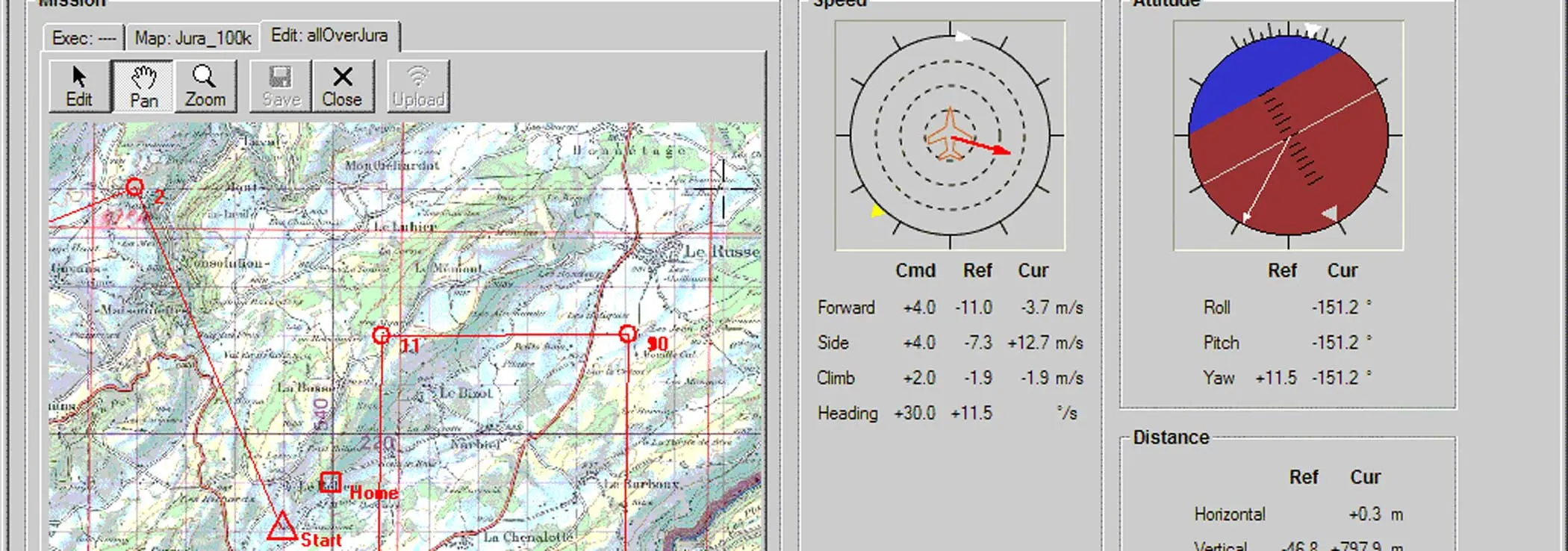
weGCS is a flight planning and control software for the ground station of an unmanned aircraft or helicopter. A new software solution was needed to quickly and efficiently replace several predecessors whose functionality left much to be desired, especially with regard to flight planning and the use of discretionary maps usable without conversion software, but also with regard to stability.
Outcome
We developed the compete visualization software for the UAV (Unmanned Aerial Vehicle). On a laptop computer, flight paths can easily be planned and entered on any bitmap map using the mouse. During the flight, the overall status of the aircraft is displayed, including visualization of its position on the map.
Thus, the needs of the end customers and users were quickly satisfied and the first systems were sold.
Implementation
Our quick familiarization with cartography and geodesy ensured that a simple solution for the user could be found for the use of bitmap maps.
By using an iterative, agile development approach, our client was able to deliver robust software to the end users very quickly, and we were able to efficiently incorporate user feedback back into the software.
Customer
weControl was an ETH Zurich spin-off that developed and marketed control systems for unmanned helicopters and fixed-wing aircraft. Following a merger with Survey Copter in France, both companies were acquired by Airbus.
Project Scope
Expertise
- Graphical User Interfaces
- Geodesy/cartography
Technologies
- C++
- wxWidgets
Would you like to be able to offer a product quickly? Send me an email!